


Why is Mt. Washington so windy?
The weather is pretty bad up there
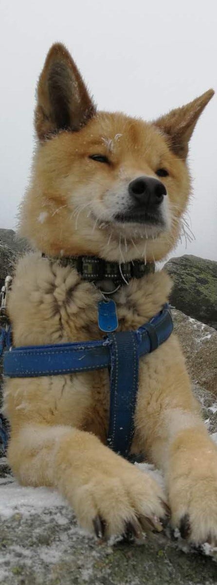
A few weeks ago, my mom, my dog, Macy, and I climbed up to the summit of Mt. Washington, the highest peak in the Presidential Range of the White Mountains in New Hampshire—and the highest peak in the Northeast US. If you live in New England or around New York, and are an avid hiker of any sort, you’ve probably heard of it—or at least seen those bumper stickers that proudly proclaim that “This Car Climbed Mt. Washington.”
On the day of our climb, the temperature was in the mid to high 40s, the sky sunny and clear, the winds light and variable, as they say. But as we cleared the treeline—above about 4,500 feet in elevation, although this varies—the weather turned. The first thing we noticed was the cold. The temperature had been dropping steadily, mile by mile, as the elevation increased—but without the shielding of the spruce and fir of the boreal forest, the cold seemed more insistent. Some of the chill was due to the wind, which began to howl, literally. Gusts came so strong that it felt like I had to match the angle of my body to the slope of the ground to avoid being blown away. Then came the precipitation—freezing rain at first, and then, bits of snow and ice, which coated the ground and made the rocky terrain even harder to see. Soon, it seemed we were caught in the middle of a blizzard. A combination of the snow and the rolling fog reduced the visibility to near zero. The exact way up the mountain, which already was just the easiest way to make your way up an endless rock pile, became impossible to see. We would stagger blindly for a few seconds until, like a beacon of light, the next cairn emerged from the thickening white mist.
Eventually, we made it to the summit, where we soon discovered that everyone was trying to make their way down. The cafe employees serving lunch to (mostly) visitors who drove up the mountain were shutting down the place early, telling customers that they had to make it back down the auto road before the storm was got worse. The customers, as you might guess, did not like this explanation. "Well, what are we supposed to do?!” I heard a woman say.
Anyway, long story short, we managed to make it back down the way we came up (on foot, that is). The experience made it clear to me that all the tales about Mt. Washington were true—indeed, it had some of the most extreme weather on Earth. But why?
It’s not really all that tall. At 6,288 feet, it is the tallest peak in the Northeast, as I’ve said. But as my friends from California like to say, “mountains on the East Coast are just hills.” Ouch. By comparison, though, there’s some truth. The highest mountain in the US is Denali in Alaska, at 20,310 feet. In the continental US, the honor goes to Mt. Whitney in California, at 14,505 feet. East of the Mississippi, Mt. Washington falls behind Mount Mitchell (6684’), Clingmans Dome (6643’), and other peaks located in the Blue Ridge and Great Smoky Mountain ranges in North Carolina and Tennessee.
It’s not really all that cold, either. The record low average monthly temperature was -47F, recorded in January of 1934. The normal monthly average for the coldest months is about 5 degrees F. Compare that to a place like Antarctica, where, although recorded temps range depending on what station they’re being taken at, average monthlies can be colder than -70F during the winter.
With an average of about 91 inches of rain a year, Mt. Wash is pretty wet, especially compared to the frozen desert of Antarctica. Perhaps what truly distinguishes Mt. Washington, though is the wind. For years, it held the record for the fastest wind speed, at 231 mph, taken on April 12, 1934. (This record was beaten in 1996 when a speed of 253 mph was recorded by an unmanned station on Barrow Island, Australia. However, Mt. Washington still holds the record for the highest speed recorded by a human being.) Typical wind speeds aren’t nearly that fast, but monthly averages for the windiest months (Jan/Feb) still hover around 45 mph. Coupled with the cold temps, this brings a bitter wind chill—in fact, Mt. Washington broke the record for the coldest wind chill ever in US history in February of this year, dropping to 108 degrees below zero Fahrenheit with wind gusts above 120 mph.
Which begs the question, the main mystery in my mind: what makes it so windy?
I hunted the interwebs and came across some mostly generic answers—it’s at the confluence of several storm tracks, or it funnels wind, yadda yadda. But what storm tracks? And how does it funnel wind?
After sifting through several blog posts and dredging up long forgotten/suppressed memories of high school geosciences, I’ve satisfied myself with two main answers to this question.
#1: The Topography.
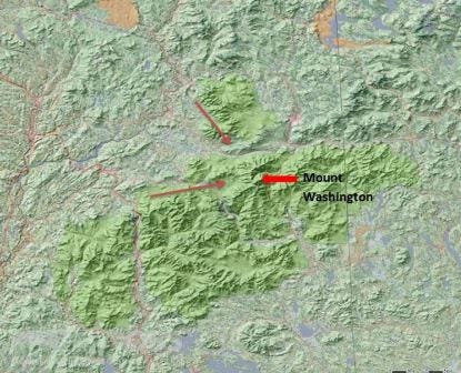
This blog post does a good job of laying out the first reason. Essentially, the shape of the Presidential Range in which Mt. Washington sits forms a V, with the apex of the V at Mt. Washington and the opening of the V directed westward.Wind traveling from the west thus gets funneled towards the highest point—and because there isn’t anything tall blocking the wind for over 1,500 miles, it all gets pushed here. (This length of land over which the wind blows unimpeded is dubbed the “wind fetch.”) The direction of the V also explains the direction of the winds on Mt. Washington: always west.
Wind then gets squeezed between the peak and the top of the trophosphere—which is the layer of the atmosphere where weather happens and where we live and breathe. This is called the tropopause, and separates the troposphere from the higher stratosphere.
As the wind gets squeezed, it speeds up, kind of like what happens when you put your thumb over the nozzle of a garden hose. Because of conservation of mass, the total amount of fluid coming in per unit time has to equal the total amount of fluid coming out. So if the fluid is flowing in a narrower tube of sorts—as air does when it passes between the peak of Mt. Washington and the tropopause—it moves faster to make up for it.
#2: The Storm Tracks.
Storm tracks essentially refer to the paths on which storms travel. First, it helps to note that typically storms are associated with low-pressure systems, while high-pressure systems are associated with clear skies. This is because a low-pressure area in the atmosphere is kind of like a vacuum or black hole—it draws wind towards it as air moves from high to low pressure. (High-pressure systems, as you can conclude, do the opposite and drive wind away.)
Low-pressure systems don’t just develop in random areas—although individual storms follow unique trajectories, in general, low-pressure systems follow certain patterns. These patterns depend most fundamentally on where land and water are located on the Earth’s crust, and basic circulation patterns of air in the atmosphere.
I am not a meteorologist, so I understand this only on very simple terms, aided by this website provided to me by a kind Redditor describing five major storm track patterns in the US. It’s from a news channel in Omaha, so it’s Nebraska-centric, but it’s clarifying for weather on Mt. Washington as well.
There seem to be three main systems or “common storm tracks” that Mt. Washington lies at the center of.
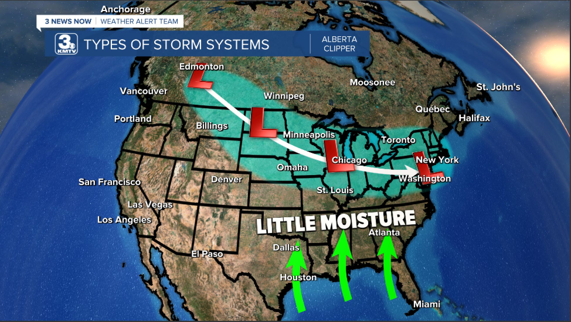
The Alberta Clipper, aka Alberta low, Alberta cyclone, Canadian Clipper, or just a clipper. (Also, the more dramatic monikers Manitoba Mauler and Saskatchewan Screamer.) These originate from Alberta, to the east of the Canadian Rockies, and move E/SE towards the US. They develop due to moist air from the Pacific encountering cold, dry air from the Rockies.

Example of a track of an Alberta Clipper storm system. (credit) The Nor’easter. This term is familiar to anyone living along the I-95 corridor from D.C. to Boston, as it stalks the East Coast, bringing along notorious blizzards in the winter. It forms from the interaction between the polar jet stream and warm air from the Gulf of Mexico. Jet streams are hard to explain, and I’m not sure I fully understand it myself, but they’re essentially bands of strong winds in the atmosphere that form due to the rotation of the Earth acting on air moving from the warm equator to the cold poles. There are several jet streams that divide so-called “circulation cells” on Earth, with the polar jet stream hanging around about 50-60 degrees latitude.

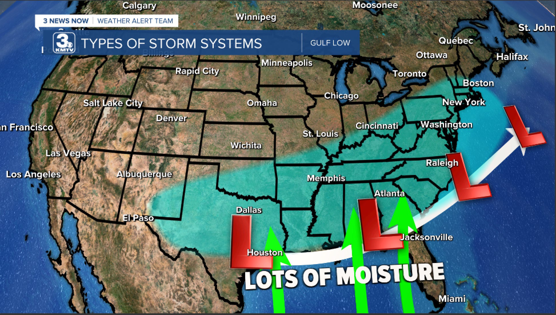
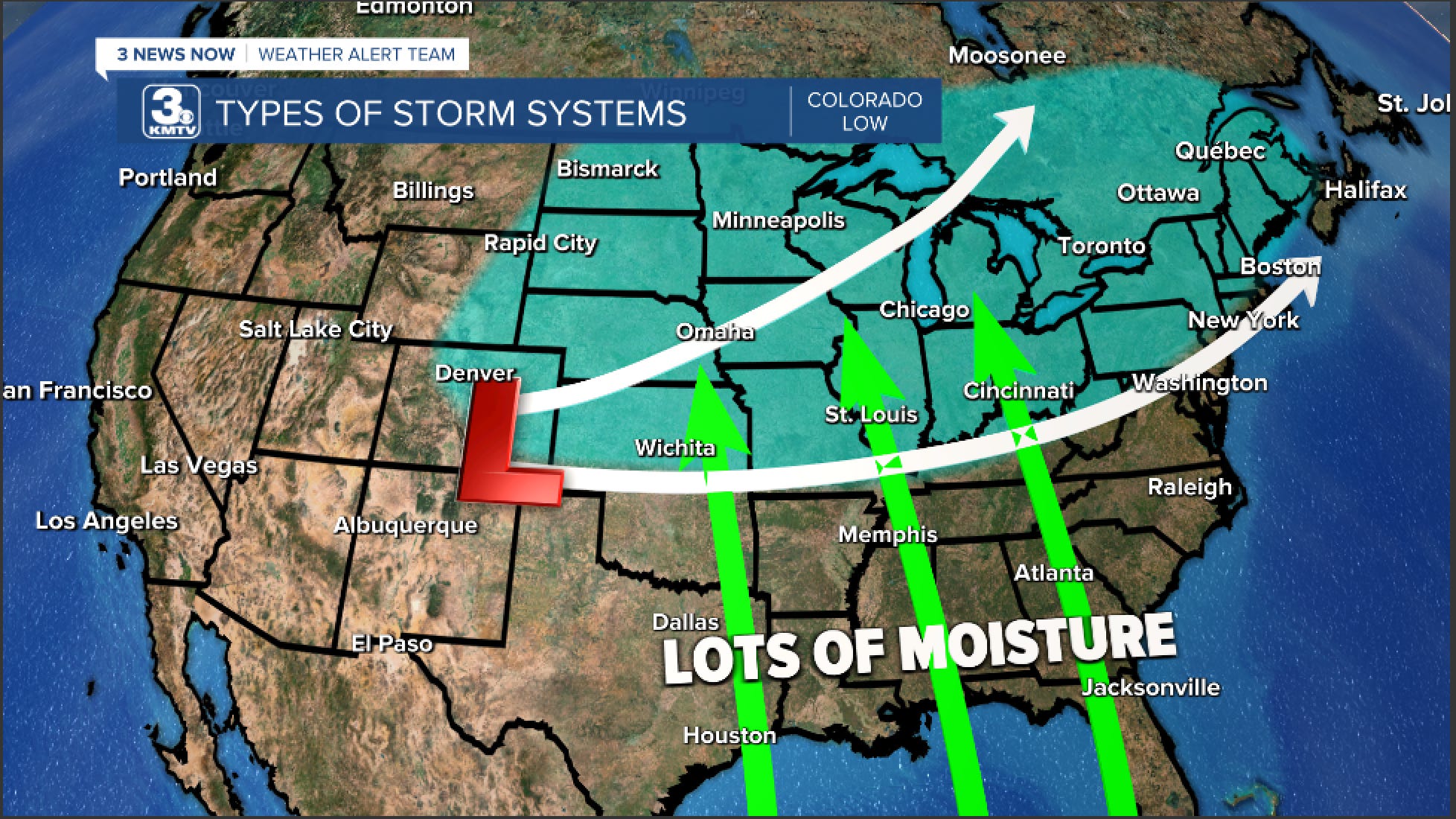
Example of a track of a Nor’easter. (credit) Panhandle Hooks and/or Colorado Lows. Colorado Lows form off the Rocky Mountains and move across to the east/northeast. Panhandle Hooks form in the panhandles of Texas and Oklahoma and move towards the Northeast/Great Lakes region.
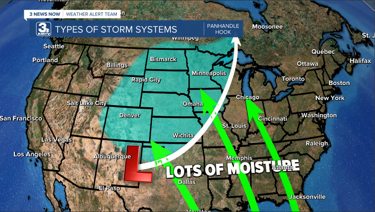

Example of a track of a Panhandle Hook (above) and Colorado Low (below). (credit)

This is probably far from the most scientific explanation, but I have satisfied my curiosity to the best of my ability—for now, at least. Did I miss anything?